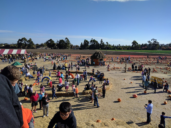
Vargas Plateau Regional Park is a 1,249-acre East Bay Regional Park District preserve at 2536 Morrison Canyon Rd, Fremont, CA 94539, in the Fremont Hills above the Warm Springs and Mission San Jose area. Opened to the public in 2015 on former ranchland, it draws hikers and birdwatchers for open grasslands, wooded gullies, raptor habitat, and long views across southern San Francisco Bay toward the Peninsula and Silicon Valley.
What to Expect at Vargas Plateau Regional Park
This is a quiet, exposed hillside park rather than a landscaped city park. From the Morrison Canyon Road staging area, unpaved routes climb through cattle-grazed grassland and oak-lined drainage areas to the plateau. The elevation and open slopes create the park’s defining experience: broad Bay views on clear days, with Mission Peak and the Diablo Range framing the inland horizon. Winter and spring bring green hills and wildflower color; by late spring the terrain is generally dry and golden.
Build a walk around the Upper Ranch Trail and Deer Gulch Trail, two of the principal routes through the preserve. The Upper Ranch Trail gives a more open plateau perspective, while Deer Gulch follows a more enclosed drainage before climbing back into grassland. Keep a measured pace on the grades and scan fence posts, thermals, and ridgelines for hawks and eagles. There is no visitor center, café, or formal exhibit space here: bring water, sun protection, and a downloaded map before setting out.
- Fremont Hills setting: The 1,249-acre preserve rises above Fremont, giving its trails an expansive south-Bay outlook.
- Upper Ranch Trail: An unpaved route through open ranch country, suited to walkers seeking plateau views and wide skies.
- Deer Gulch Trail: A more varied route that passes through a drainage landscape before reconnecting with higher grassland.
- Raptor watching: Eagles and hawks are a central reason to pause at overlooks and scan the open slopes.
- Ranchland character: Grazed grasslands, oak-fringed gullies, gates, and rolling terrain preserve the site’s working-landscape feel.
Vargas Plateau Regional Park at a Glance
| Detail | Information |
|---|---|
| Address | 2536 Morrison Canyon Rd, Fremont, CA 94539 |
| Neighborhood / Area | Fremont Hills, above the Warm Springs and Mission San Jose area |
| Operating Hours | Daily, 8am–9pm |
| Admission / Price Range | Free day use; $ |
| Recommended Visit Duration | 1.5 to 2.5 hours |
| Nearest Transit / Parking | No direct rail or bus service to the trailhead; free on-site parking at the Morrison Canyon Road staging area |
| Official Website & Phone | East Bay Regional Park District; +1 510-544-3246 |
Visiting Tips, Getting There & Nearby Pairings
Arrive early, particularly on clear weekend mornings, when the small staging area is easiest to use and the exposed trails are cooler. No timed entry or reservation is required for ordinary day hiking. Wear shoes with grip for dirt and potentially muddy winter sections, close gates behind you, and give grazing animals generous space. Summer afternoons can be hot because shade is intermittent; check the Park District’s official park page for alerts, closures, and current trail conditions before leaving Fremont.
Driving is the practical way to reach the park; public transit does not deliver visitors directly to the Morrison Canyon Road entrance. The parking area is the starting point for walks, but the trail network is unpaved, rolling, and at times steep, so it is not a smooth step-free outing for most wheelchairs or strollers. There is no developed attraction or dining strip within a 5–15 minute walk of the trailhead. For a same-day outdoor pairing, drive to Mission Peak Regional Preserve, the Alameda Creek Regional Trail, or Coyote Hills Regional Park after your hike.
Frequently Asked Questions
What are Vargas Plateau Regional Park’s hours, and when is the best time to go?
The park is open daily from 8am to 9pm. Start near opening for cooler temperatures, easier parking, and clearer views before afternoon haze develops over the Bay; spring is especially appealing for green hillsides.
Is there an admission fee or a reservation requirement?
Day use is free, and ordinary hiking does not require a reservation or timed ticket. There are no restaurant or visitor-center purchases on site, so carry your own water and trail snacks.
How much time should I allow for a visit?
Allow 1.5 to 2.5 hours for a satisfying out-and-back or short loop combining the principal trails and viewpoint stops. Add time if you are photographing landscapes or watching for raptors, and plan conservatively on warm days because climbs are exposed.
Is Vargas Plateau suitable for families, strollers, and wheelchair users?
Active families with older children can enjoy the open trails, provided everyone is prepared for sun, grades, and uneven surfaces. The park’s dirt-and-gravel routes climb rolling hills and no dedicated paved accessible trail is identified, making it difficult for standard strollers and many wheelchairs.
When planning your Fremont travel guide or comparing verified attractions and parks in Fremont, pair this stop with standout local spots including Sala Thai Restaurant, DeAfghanan Cuisine, Courtyard Newark Silicon Valley, and Secret Sidewalk (2.4 km away).