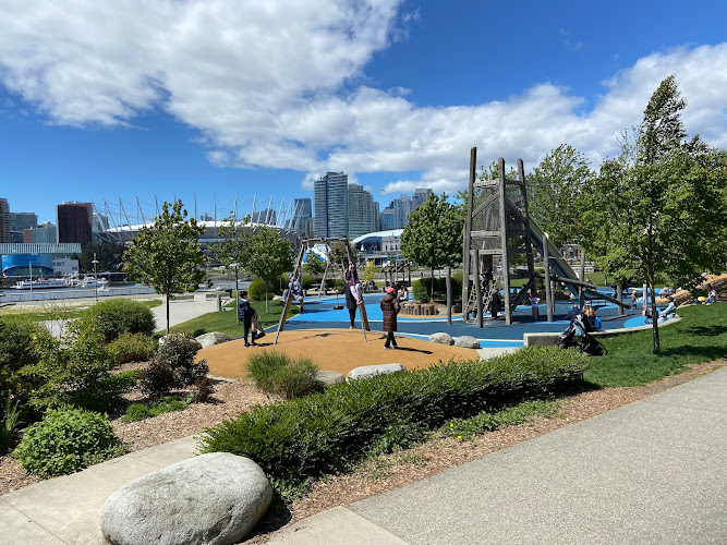
Vancouver Seawall is the city’s signature waterfront route: a broad, paved promenade tracing the edge of Stanley Park before continuing through Coal Harbour, English Bay and False Creek. Its best-known section forms an approximately 9-kilometre loop around Stanley Park, where Burrard Inlet, the North Shore mountains, forested shoreline and open water appear in quick succession.
At the northwestern edge of downtown and beside the West End, the seawall is both an everyday transport corridor and a destination in its own right. Walkers, runners, cyclists, families with strollers and photographers share its views, while the separate pedestrian and bike lanes help organize a route that can otherwise feel very busy. Construction began in 1917 as shoreline protection, and master stonemason James Cunningham directed work on the wall for more than three decades.
Standout Highlights & What Not to Miss
The appeal is not one landmark but a steady sequence of changing viewpoints. A complete Stanley Park circuit rewards unhurried visitors; a shorter out-and-back walk can still deliver the harbour-and-mountain drama that makes the route memorable. Keep an eye on lane markings and choose a section that matches your time and energy rather than treating the entire waterfront as a compulsory walk.
- Brockton Point Totem Poles: Begin near this important cluster of carved poles and interpretive area, then continue toward the inlet for an easy introduction to the route’s cultural and waterfront character.
- Lions Gate Bridge shoreline: The path passes beneath or near dramatic views of the 1938 suspension bridge, with Burrard Inlet and the North Shore beyond it.
- Siwash Rock: This distinctive offshore sea stack is one of the seawall’s classic photo stops, especially when the water and coastal cliffs are clearly visible.
- Third Beach and Second Beach: These west-side pauses break up the forest-and-rock shoreline with beach views, places to rest and a more leisurely summer atmosphere.
- English Bay toward sunset: Continue beyond Stanley Park for a broad beachscape and west-facing light; this is a popular finish rather than a quiet secret.
Visitor Strategy & Planning Snapshot
| Planning Factor | What to Expect | Practical Strategy |
|---|---|---|
| Ideal Arrival Window | Early morning is generally calmer, while late afternoon brings warmer light and more people around beaches and major viewpoints. | Start early for a relaxed ride or walk; choose a sunset finish at English Bay if you are comfortable sharing the route with larger crowds. |
| Typical Time Needed | Most visitors spend about 1.5 to 3 hours, depending on whether they walk, jog, cycle or make beach and photo stops. | Allow extra time for the Stanley Park loop, especially if stopping at the totem poles, viewpoints and beaches. |
| Booking / Queue Reality | The path itself is an open public route, but bike rentals, nearby attractions and seasonal food stops can be busiest on fine-weather days. | Secure rentals earlier in the day and do not rely on a particular concession as your only refreshment plan. |
| Terrain & Accessibility | The route is paved, flat and largely step-free. Accessible washrooms are available at Second Beach, Third Beach and Lumberman’s Arch. | Pedestrians should remain in their designated lane; wheels travel counterclockwise on the Stanley Park route, so check signs before setting off. |
| Weather / Seasonal Fit | Clear days sharpen mountain and bridge views; rain, wind and cooler months can make exposed sections feel very different. | Bring layers and rain protection, and leave room to shorten the outing if conditions turn wet or gusty. |
Honest Trade-Offs: Best For vs. Who Might Skip
This is an excellent fit for visitors who want a low-stress outdoor experience with repeated postcard views, a largely level surface and the freedom to choose their own distance. It works particularly well for cyclists, walkers, joggers, families managing strollers and photographers willing to pause often. The trade-off is popularity: on bright weekends and around sunset, it can feel more like an urban shared-use corridor than a remote coastal escape. Fast-moving bikes, changing lane patterns and the length of the full loop may frustrate travelers seeking solitude, a short landmark stop or a completely car-free sense of wilderness. Mobility-focused visitors will appreciate the paved surface, though wind, crowding and long stretches between preferred stops still merit planning.
Neighborhood Context & How to Pair Your Visit
Use the seawall as the spine of a walkable Vancouver day rather than a standalone exercise route. From the downtown side, pair Brockton Point and Coal Harbour with a stroll through Stanley Park; continue west for Third Beach, Second Beach and English Bay, then explore the West End on foot. Visitors with more time can follow the waterfront south around False Creek toward Granville Island, turning one scenic outing into a sequence of neighbourhoods, beaches and harbour views. For a simpler plan, choose one anchor—totem poles, Lions Gate Bridge views, Siwash Rock or English Bay—and walk out and back, saving the full circuit for a day when weather and energy are on your side.
When planning your Vancouver travel guide or browsing verified attractions in Vancouver, pair this stop with standout local spots including Beaches Restaurant & Bar, Rosewood Hotel Georgia, Beaty Biodiversity Museum, and The Westin Bayshore, Vancouver (0.4 km away).