
Back to Lauterbrunnen Guide

Top Hiking Areas in Lauterbrunnen

Explore curated hiking area across global travel destinations on Destinations.ai. This directory index focuses on Marked trail systems, wilderness preserves, and scenic overlooks suited for day hikers and nature walks. Each profile delivers verified operational information, address coordinates, expected price levels, and practical visitor tips to help travelers navigate the area efficiently. Whether you are building a full-day neighborhood itinerary or looking for a trusted local spot near your hotel, our guides filter out unverified listings so you can plan with reliable, fact-checked details.

4 Listed places
4.8 average across 4 rated listings
Unnamed Road • Losisgräbli 419 • Lengwald 301
Free waterfall access; transport and parking cost extra – Free trail; BLM railway and Allmendhubel funicular tickets are charged separately.
Popular Neighborhoods:
Unnamed Road Losisgräbli 419 Lengwald 301

Flower Trail

Famous for: A signed Allmendhubel-to-Mürren meadow walk introducing Alpine flowers beneath the Eiger, Mönch and Jungfrau.

Follow Alpine flower markers from Allmendhubel to car-free Mürren, with Bernese Oberland views and a one-hour meadow walk.

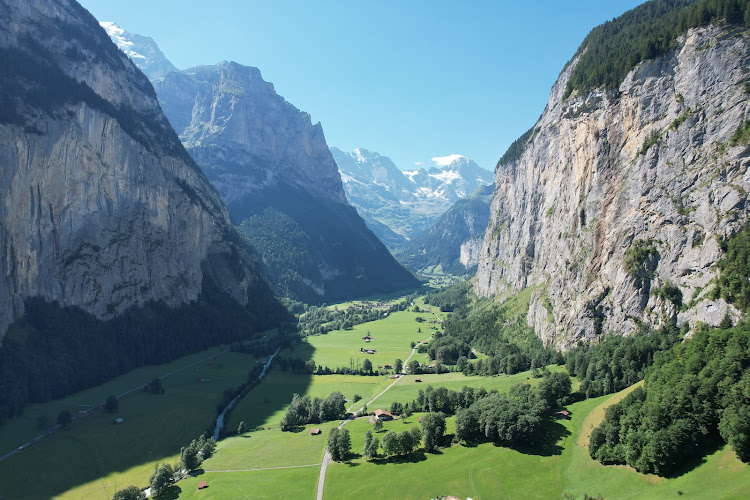
Nature enthusiasts families with active children photographers

Hasenbach Falls

Unnamed Road
Famous for: A natural cascade on Lauterbrunnen’s eastern valley flank, set beneath the steep Wengen mountainside.

Explore Hasenbach Falls on Lauterbrunnen’s eastern valley slope, with practical advice on walking access, seasonal flow, transport and nearby sights.

Experienced walkers Waterfall photographers Alpine nature enthusiasts

Staubbachfall Waterfall

Losisgräbli 419
Famous for: A 300-metre free-falling Alpine waterfall and seasonal close-up gallery that inspired Goethe.

See Lauterbrunnen’s 300-metre Staubbachfall, Goethe’s inspiration, with a free seasonal gallery behind the spray.

Nature lovers photographers hikers

Thrill Walk, Birg

Lengwald 301
Famous for: A cliffside walkway with glass flooring, balancing obstacles and views of the Eiger, Mönch and Jungfrau.

Explore Birg’s 200-meter Thrill Walk above Mürren, with glass flooring, cliffside obstacles and Eiger views, reached by cable car from Stechelberg.

Confident family adventurers Mountain photographers Heights-loving couples
Planning guide

The Insider's Guide to Hiking area in Lauterbrunnen

Lauterbrunnen’s hiking-area directory brings together four verified venues in Bern, Switzerland, with an average rating of 4.8/5. The selection spans waterfall visits, casual hiking and height-focused adventure rather than a single walking style. Recorded address clusters—Unnamed Road, Losisgräbli 419 and Lengwald 301—provide useful anchors for comparing listings, not formal hiking districts. Hasenbach Falls, on Unnamed Road, suits experienced walkers and waterfall photographers; its 5/5 rating rests on just one review. Staubbachfall Waterfall, at Losisgräbli 419, scores 4.7 from 3,465 reviews, while Thrill Walk, Birg, listed at Lengwald 301 in Stechelberg, scores 4.8 from 2,440. Flower Trail also rates 4.7 and is recorded as suitable for casual hikers and families with active children. Destination indicators of 80/100 for safety and 90/100 for walkability offer broad context, not individual trail assessments. Recorded pricing distinguishes free waterfall or trail access from separately charged transport, parking and railway or funicular tickets.

The Lauterbrunnen Hiking area Scene

Use these notes to plan your visits to hiking area in Lauterbrunnen, and confirm current details with each venue.

Key Neighborhoods & Quarters

  • Unnamed Road: Hasenbach Falls is recorded here; its listing targets experienced walkers, waterfall photographers and independent travelers.
  • Losisgräbli 419: Staubbachfall Waterfall is listed at this address and appeals to nature lovers, photographers and hikers.
  • Lengwald 301: Thrill Walk, Birg, uses a Schilthornbahn AG address in Stechelberg; distinguish the recorded address from your intended walking destination when planning transport.

Essential Tips for Travelers

Practical advice on etiquette, timing, and savings for hiking area in Lauterbrunnen.

Separate access costs

Budget beyond free waterfall or trail access: recorded extras include transport, parking, BLM railway and Allmendhubel funicular tickets.

Check booking needs

Confirm any transport ticket or reservation requirements before departure; reservation rules are not supplied in the verified listings.

Verify seasonal operation

Check current trail access and transport operating hours before choosing a date; seasonal schedules are not recorded here.

Frequently Asked Questions

Essential planning questions answered for exploring hiking area in Lauterbrunnen.

What kinds of hiking-area visits are listed in Lauterbrunnen?

The four verified venues cover waterfalls, Flower Trail for casual hikers and active families, and Thrill Walk, Birg, for visitors comfortable with heights.

Which venue has the highest rating?

Hasenbach Falls scores 5/5 from one review; Thrill Walk, Birg, scores 4.8 from 2,440, while Flower Trail and Staubbachfall Waterfall each score 4.7.

Are the hiking areas free?

Recorded price context includes free waterfall access and a free trail, but transport and parking cost extra; BLM railway and Allmendhubel funicular tickets are charged separately.

What transit details should I check?

Verify the transport needed for your chosen venue and current ticket arrangements; the database names BLM railway and Allmendhubel funicular but supplies no routes or timetables.

When is the best time to visit?

The verified records do not establish a best season or time of day; confirm current access and operating hours before planning your visit.