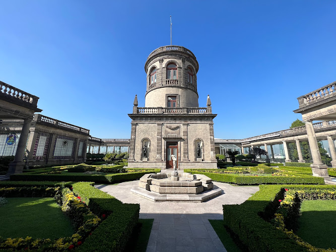
State of Mexico is Mexico’s central highland state, surrounding much of Mexico City and officially administered from the Palacio del Poder Ejecutivo, Avenida Sebastián Lerdo de Tejada 300, Colonia Centro, 50000 Toluca de Lerdo, State of Mexico, Mexico. Created as a constituent state in 1824, it encompasses major pre-Hispanic, colonial and mountain landscapes rather than a single gated attraction. Travelers come for the monumental city of Teotihuacan, the lakeside activities of Valle de Bravo, the high-altitude Nevado de Toluca and Toluca’s museums, markets and civic architecture.
What to Expect at State of Mexico
The most internationally recognized stop is the UNESCO-listed Archaeological Zone of Teotihuacan, northeast of Mexico City. Walk the Avenida de los Muertos between the Pyramid of the Moon and the Pyramid of the Sun, then study the carved feathered-serpent façades and apartment-compound remains around the Ciudadela. Teotihuacan developed centuries before the Mexica period, reaching its height roughly between the first and sixth centuries CE; it is not an Aztec ruin. The on-site Museo de la Cultura Teotihuacana adds objects and context to the open-air route.
Other experiences demand a different pace and base town. Valle de Bravo pairs its reservoir with sailing, kayaking and paragliding launches, while the nearby Monarch Butterfly Biosphere Reserve receives migrating butterflies seasonally. In the Toluca area, the early-20th-century former market housing the Cosmovitral Jardín Botánico contains Leopoldo Flores’s large stained-glass cycle, including the central Hombre Sol window, amid tropical plantings. Nevado de Toluca, also called Xinantécatl, offers high-elevation views toward its crater lakes when access and weather permit; conditions can change rapidly.
- Teotihuacan: Avenue of the Dead, the Pyramids of the Sun and Moon, the Ciudadela and the Temple of the Feathered Serpent.
- Valle de Bravo: A lakeside town for boating, sailing, kayaking, paragliding and a compact colonial-era center.
- Cosmovitral: Toluca’s botanical garden and stained-glass environment inside a former iron-and-glass market building.
- Nevado de Toluca: A volcanic highland landscape with crater-lake viewpoints, subject to route restrictions and alpine weather.
- Malinalco: A hilltop Mexica ceremonial complex cut into bedrock, above a colonial town center.
State of Mexico at a Glance
| Detail | Information |
|---|---|
| Address | State of Mexico, Mexico; official administrative seat: Avenida Sebastián Lerdo de Tejada 300, Colonia Centro, 50000 Toluca de Lerdo. |
| Neighborhood / Area | A state-wide destination; the government seat is in Centro, Toluca de Lerdo. |
| Operating Hours | No statewide operating hours. Archaeological sites, parks and museums keep independent schedules. |
| Admission & Ticket Prices | Free to enter the state; admission is paid or free depending on the individual museum, archaeological site or reserve. |
| Recommended Visit Duration | Two to five days for a focused itinerary; allow a full day for Teotihuacan or Valle de Bravo. |
| Nearest Transit / Parking | No single transit stop. Teotihuacan is commonly reached by bus from Terminal Central de Autobuses del Norte in Mexico City; Toluca Centro has public parking garages. |
| Official Website / Phone | Government of the State of Mexico; contact the individual attraction for visitor services. |
Visiting Tips, Getting There & Nearby Pairings
Start Teotihuacan near opening time to walk the exposed Avenue of the Dead before midday heat and tour groups arrive; buy admission through the site’s official operator when available and carry sun protection and water. Buses from Mexico City’s Terminal Central de Autobuses del Norte are the practical public-transport option for Teotihuacan. For Toluca and Valle de Bravo, intercity buses and a car are useful, while Nevado de Toluca requires particular care: confirm road, park and weather conditions before committing to the mountain route.
Accessibility varies sharply by location. Central Toluca has relatively level urban routes, though some sidewalks and historic surfaces are uneven; Teotihuacan’s main avenues are broad but unpaved in stretches, and pyramid climbs use steep stairs. The crater and trails at Nevado de Toluca are not wheelchair or stroller routes. Around the Toluca administrative seat, Plaza de los Mártires and Toluca Cathedral are roughly a 5-to-10-minute walk, while the Cosmovitral and the cafés under Los Portales can be reached in about 10 to 15 minutes on foot.
Frequently Asked Questions
What are the best hours to visit the State of Mexico?
The state has no universal hours because it is a geographic destination. Plan major outdoor sites early in the day; Teotihuacan generally operates daytime hours on a Tuesday-to-Sunday schedule, while museums, reserves and mountain access have their own calendars.
Do I need tickets or reservations?
There is no ticket to enter the state. Teotihuacan and some museums charge separate admission, and organized activities such as paragliding, boat rentals or guided butterfly-reserve visits should be arranged with their operators in advance, especially on weekends.
How much time should I budget?
Allow four to six hours for Teotihuacan including transport and the museum, a full day for Valle de Bravo, and two to three hours for central Toluca and the Cosmovitral. A two- or three-day trip allows time to combine these areas without rushing.
Is the State of Mexico suitable for families and wheelchair users?
Families will find museums, lake activities and large archaeological spaces appealing, but terrain matters. Strollers work best in central Toluca and paved museum interiors; Teotihuacan has rough paths and stairs, and Nevado de Toluca is unsuitable for wheelchairs and most strollers.
When planning your Mexico City travel guide or browsing verified attractions in Mexico City, pair this stop with standout local spots including Constitution Plaza, Museo Soumaya, Museo de Arte Popular, and Desierto de los Leones (48.2 km away).