Back to Moab Guide

Top Hiking area in Moab

Explore curated hiking area across global travel destinations on Destinations.ai. This directory index focuses on Marked trail systems, wilderness preserves, and scenic overlooks suited for day hikers and nature walks. Each profile delivers verified operational information, address coordinates, expected price levels, and practical visitor tips to help travelers navigate the area efficiently. Whether you are building a full-day neighborhood itinerary or looking for a trusted local spot near your hotel, our guides filter out unverified listings so you can plan with reliable, fact-checked details.

4 Listed places
4.8 average across 4 rated listings
Arches Nat'l Pk Rd β€’ Arches Scenic Dr β€’ Flat Pass Rd
Free; no admission fee or day-use permit – Included with Arches National Park entry fee (paid per vehicle or by pass); no separate arch charge
Popular Neighborhoods:
Arches Nat'l Pk Rd Arches Scenic Dr Flat Pass Rd

Balanced Rock

Arches Scenic Dr
Famous for: A house-sized sandstone boulder balanced on a narrow pedestal, one of the most photographed rock formations in Arches National Park

A 128-foot sandstone pedestal topped by a 3,600-ton boulder in Arches National Park, with a 0.3-mile loop trail beside Arches Scenic Drive…
Photographers Geology Enthusiasts Families

Corona Arch

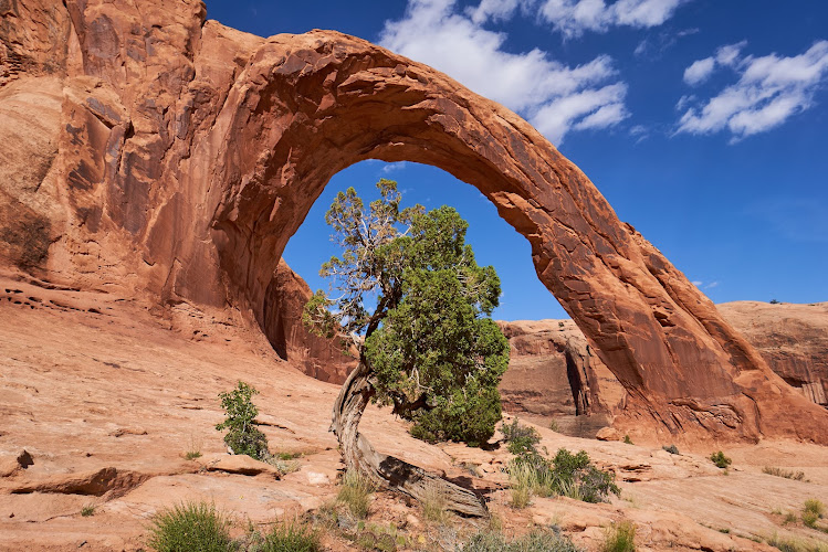
Famous for: A 140-foot-wide red sandstone arch reached by a 3-mile National Recreation Trail with cables and a ladder near Moab

Hike the 3-mile National Recreation Trail to 140-foot Corona Arch outside Moab, with cables, a ladder, and Bowtie Arch en route.

Hikers Photographers Adventure Seekers

Faux Falls

Flat Pass Rd
Famous for: A seasonal man-made waterfall and short desert hike below Ken’s Lake in Spanish Valley.

Faux Falls near Ken’s Lake is a free, seasonal man-made cascade in Spanish Valley, reached by a roughly 2-mile desert hike south…

Families Photographers Desert hikers

Sand Dune Arch

Arches Nat'l Pk Rd
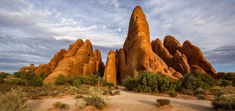
Famous for: A low, shaded sandstone arch hidden among narrow red-rock fins and reached by a soft, beachlike red sand trail

Sand Dune Arch is a short, shaded walk through red sand and sandstone fins in Arches National Park, about 5 miles north…

Families with kids Photographers Casual hikers
Planning guide

The Insider's Guide to Hiking area in Moab

Moab’s four verified hiking-area listings average 4.8 out of 5, with individual ratings spanning 4.7–4.9. The selection connects landmark photography, family outings, and desert hiking rather than presenting a single kind of walking experience. Corona Arch earns 4.9 from 987 reviews and is recorded for hikers, photographers, adventure seekers, and families with older children. Sand Dune Arch, also rated 4.9, anchors Arches Nat’l Pk Rd with a listing suited to casual hikers, families with children, and summer visitors seeking shade. Along Arches Scenic Dr, Balanced Rock carries a 4.8 rating and appeals to geology enthusiasts, photographers, families, and road-trippers. Flat Pass Rd adds Faux Falls, rated 4.7 and listed for desert hikers, families, photographers, and summer road-trippers. Recorded pricing ranges from free access without an admission fee or day-use permit to access included with Arches National Park entry. Use these distinctions to shortlist stops, then verify each venue’s current access arrangements.

The Moab Hiking area Scene

Use these notes to plan your visits to hiking area in Moab, and confirm current details with each venue.

Key Neighborhoods & Quarters

  • Arches Nat'l Pk Rd: Sand Dune Arch is recorded here; consider it for casual hikers, families with children, and summer visitors seeking shade.
  • Arches Scenic Dr: Balanced Rock is recorded here and suits photography, geology interests, family outings, and road-trip stops.
  • Flat Pass Rd: Faux Falls is recorded here; its listed audiences include families, desert hikers, photographers, and summer road-trippers.

Essential Tips for Travelers

Practical advice on etiquette, timing, and savings for hiking area in Moab.

Entry Check

Confirm the chosen venue’s entry cost and whether reservations are required; recorded pricing includes both free and park-entry-inclusive access.

Transport Check

Verify transport options for each address rather than assuming the listings connect comfortably on foot; Moab’s recorded Walkability Score is 45/100.

Seasonal Check

Confirm current opening hours and access before departure; the database does not supply seasonal schedules.

Frequently Asked Questions

Essential planning questions answered for exploring hiking area in Moab.

How highly rated are Moab’s hiking areas?

The four verified listings average 4.8/5; Corona Arch and Sand Dune Arch lead at 4.9, followed by Balanced Rock at 4.8 and Faux Falls at 4.7.

Which listings suit families?

Sand Dune Arch, Balanced Rock, and Faux Falls list families among their audiences; Corona Arch specifically lists families with older children.

Are these hiking areas free?

Recorded pricing includes free access with no admission fee or day-use permit, plus access included with Arches National Park entry paid per vehicle or by pass, with no separate arch charge. Confirm the applicable arrangement for your chosen stop.

Can I reach the hiking areas by public transit?

No transit routes or services are verified in this dataset. Moab’s recorded Walkability Score is 45/100; check transport to each listing separately.

When is the best time to visit?

The records do not establish an overall best season or time of day. Sand Dune Arch is listed for summer visitors seeking shade, and Faux Falls for summer road-trippers; verify current hours and access before choosing a date.